In the summer of 1928, Louise Arner Boyd arrived in Norway with a ship, money, cameras, and a fairly straightforward plan.
She was going back to the Arctic.
Her previous trip had involved scenery, photography, wealthy friends, and a great deal of trophy hunting. In other words, it was not yet the sort of expedition that gets introduced with the phrase “important contribution to geographical science.”1
Then Roald Amundsen disappeared.
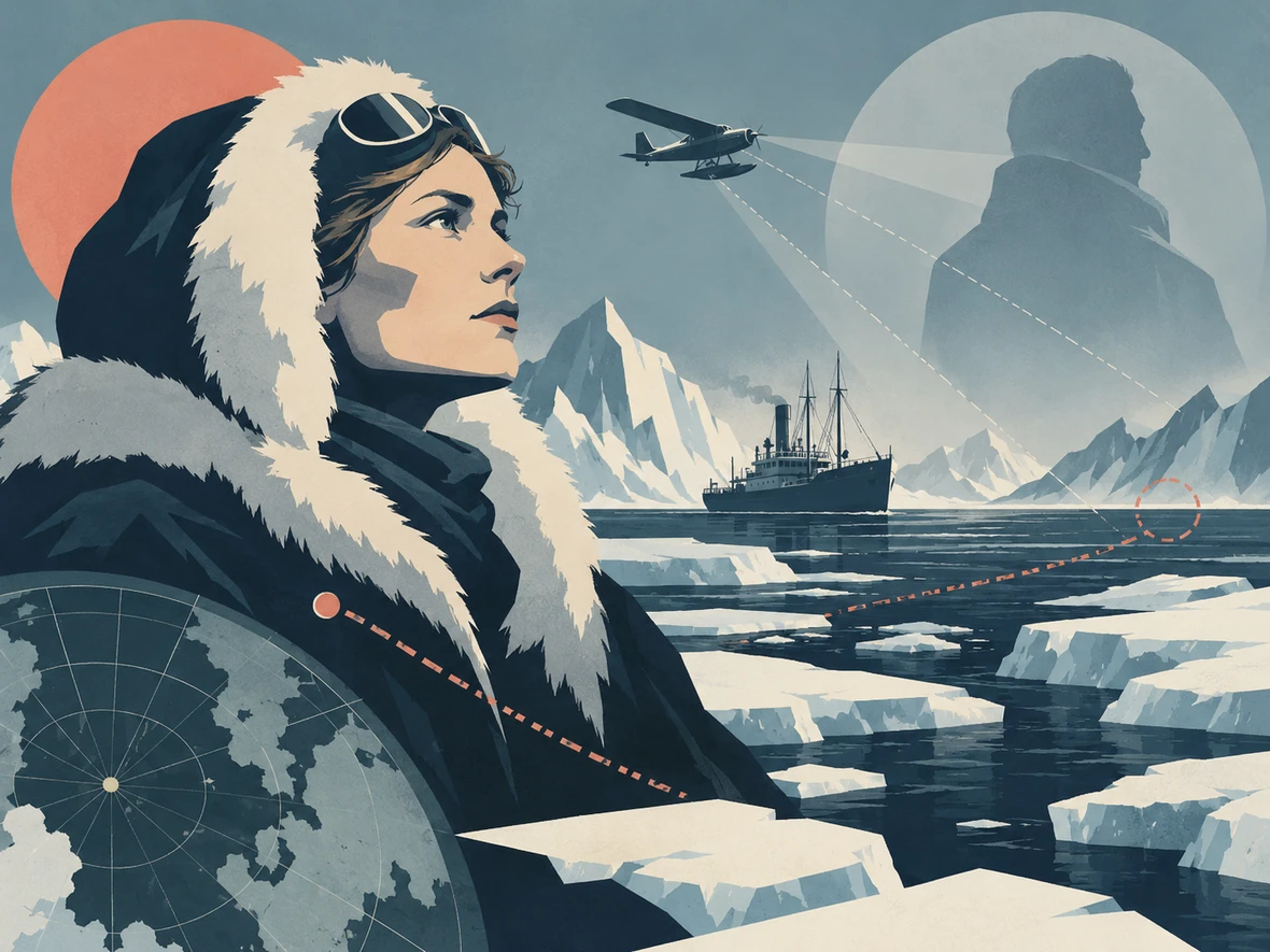
Amundsen was already one of the most famous explorers alive. He had led the first expedition to reach the South Pole and had spent decades making the polar regions slightly less blank on European maps. In June 1928 he took off in a French seaplane, the Latham 47, to help search for the missing crew of Umberto Nobile’s airship Italia.
The rescue plane vanished too.
So by the time Boyd reached Norway, the Arctic had managed to turn one missing expedition into a second missing expedition.
Boyd changed her plans immediately.
She placed the Norwegian sealing ship Hobby, which she had chartered for herself, at the disposal of the Norwegian government and joined the search for Amundsen. The cruise became a rescue mission. Boyd helped outfit the ship, brought aircraft and pilots into the search, and spent roughly ten weeks moving through the Greenland Sea, around Svalbard and Franz Josef Land, looking for any trace of the missing men.1,2
The search produced nothing: no wreckage, no survivors, no clue to what had happened.
But the search did something rather important to Louise Boyd.
It introduced her to the people who actually knew how Arctic exploration worked, and it turned what had begun as an extremely expensive personal fascination into something much more serious.1
And to understand why she was able to make that turn at all, we need to go back to California.
Boyd was born in San Rafael in 1887, into a family with a great deal of money. Her father, John Franklin Boyd, had interests in mining and business. Louise grew up on a large estate, travelled comfortably, and received the sort of private education available to wealthy families in northern California.2
Then, over a relatively short period, the family contracted dramatically.
Her two brothers died young. Her parents died in 1919 and 1920. Louise became the principal heir to the family fortune.1
This matters because Arctic exploration is one of those professions where determination is useful but a ship is still going to ask for money.
Boyd could pay.
That gave her an unusual degree of independence. She did not have to convince a university, government department, newspaper syndicate or wealthy sponsor that a proposed expedition would produce the correct mixture of prestige and headlines. She could charter the vessel herself.
At first, she used that freedom exactly as a rich person in the 1920s might be expected to use it.
She travelled.
In 1924 she went north along the Norwegian coast and reached the edge of the polar ice. The experience got hold of her. Two years later she chartered the Hobby for a much larger expedition toward Franz Josef Land.1,6
And this first proper expedition is a useful antidote to the temptation to turn Boyd into a modern saint in polar clothing.
She went partly to hunt.
The party killed polar bears. Contemporary coverage made a great deal of the number. Boyd herself was credited with shooting several.1
She also took thousands of feet of film and hundreds of photographs, documented sea ice, collected plants, and paid close attention to the landscape. Even before the scientific phase of her career, the cameras were already becoming more than souvenirs.1
So when she returned in 1928 and the Amundsen emergency blew up around her, she was not transformed from “person with no interest in science” into “scientist” in one cinematic moment.
What changed was the purpose.
The Arctic stopped being somewhere she visited for experience and became somewhere she wanted to study.
The search covered about 10,000 miles and reached deep into the polar seas. Boyd filmed the work as they went. The National Archives still preserves the expedition footage, including the preparations, aircraft and long stretches of ice that tell you something about what searching for one missing aeroplane in the Arctic actually meant.1,2

Mostly, the footage shows a great deal of looking.
Norway later awarded Boyd the Order of St. Olav for her role in the search, and France made her a Chevalier of the Legion of Honor.2,6
But the more consequential reward was a network.
Boyd had now spent weeks around experienced polar sailors, aviators, explorers and scientists. She had seen how much careful observation could be extracted from a voyage that, on the surface, looked like a ship moving through fog and ice.
In 1931 she went back.
This time the plan was East Greenland.
And the language changes.
Her own later description called the 1931 journey a “photographic reconnaissance.” The point was not simply to go somewhere dramatic. It was to learn the terrain, photograph it systematically and prepare for more extensive scientific work.3
Boyd chartered another Norwegian vessel, Veslekari. She became expedition leader and official photographer. She worked with the American Geographical Society and learned photogrammetry: using carefully positioned photographs to extract measurements and build maps.1,2,3
This is where photography stops being the thing you do after arriving somewhere interesting and becomes part of the surveying equipment.
During the 1931 expedition Boyd took several thousand photographs. In one area, a set of more than 200 images taken from selected stations supplied enough information for the American Geographical Society to construct a detailed topographic map.2
That is a fairly impressive answer to the question:
“Did you get any pictures?”
The expedition reached the head of Ice Fjord, investigated previously uncertain geography and photographed landforms in enough detail to correct existing maps. An area between two glaciers was later officially named Louise Boyd Land.2,4
And because history enjoys making people sound slightly more self-promotional than they really were, it is worth stressing that Boyd did not sail into Greenland and name a chunk of it after herself.
Other geographers did that.
The name appears in official Greenlandic place-name records as having been applied in her honor after the mapping work of the early 1930s.4
By 1933, Boyd had assembled the sort of expedition staff that makes the transition impossible to miss: topographers, a botanist, a geologist and a physiographer. The Veslekari carried modern survey equipment, including an echo sounder for measuring water depth. The expedition investigated glaciers, coastlines, fjords, plant life and the shape of the sea floor.2
Boyd still took the photographs herself.
This point keeps recurring because she was not simply the person whose cheque arrived before departure.
She selected specialists, financed the work, led the expedition, learned the equipment and did one of its central technical jobs. Later scientific publications carried contributions from the people she brought with her, which is exactly what a serious multidisciplinary expedition is supposed to look like.2,5
Her 1931 and 1933 work became The Fiord Region of East Greenland, published by the American Geographical Society in 1935.3 She returned in 1937 and 1938, pushing farther north along the East Greenland coast and expanding the hydrographic, geological, botanical and glaciological work; the 1938 voyage carried specialized radio equipment as well.2
By now this was not rich-person tourism wearing a lab coat.
The 1938 expedition also pushed to a point on the East Greenland coast where heavy polar ice finally stopped the ship. Boyd’s party went ashore near 77°48′ north; Raye Platt’s near-contemporary account described it as, at that time, the farthest-north landing made from a ship on that coast.2
That sounds like exactly the sort of fact an explorer would frame on the wall.
Boyd’s publications are much more interested in what they measured once they got there.
Nature later reviewed Boyd’s 1948 volume The Coast of Northeast Greenland as a serious contribution not only to knowledge of the coast but to glacial geology more broadly.5
There is also an interesting complication in the timing of that book.
The research was done before the Second World War.
Publication came after it.
The United States government asked Boyd not to release the detailed results from the 1937 and 1938 expeditions while the information might have strategic value. East Greenland sat on the air and sea approaches between Europe and North America. Maps, photographs, coastal observations and radio data suddenly belonged to a category called:
Boyd handed over photographs, maps and Arctic information to the U.S. government. In 1941 she financed and led another northern expedition, this time working with the National Bureau of Standards on radio transmission, ionospheric research and magnetic observations around Baffin Bay, Davis Strait and nearby regions. She also carried out a confidential War Department assignment examining a possible aircraft landing site.1,2
Then she spent part of the war in Washington as a special consultant to Military Intelligence.2
This is a rather strange career arc for someone whose first major polar expedition had been described in the press largely in terms of how many bears she shot.
And the press never entirely stopped being fascinated by the wrong part.
A 1938 feature felt it necessary to reassure readers that Boyd might wear boots and practical clothes on an expedition but remained interested in ordinary feminine appearance. Boyd herself played along, talking about powdering her nose before going on deck.1
Apparently mapping Greenland was impressive.
Mapping Greenland while still owning face powder required clarification.
That sort of coverage tells you something about the world Boyd was working in. She had money, which removed one barrier. It did not remove the assumption that a woman leading scientific fieldwork was somehow a category error that needed to be explained to the newspaper reader.
The American Geographical Society awarded her the Cullum Geographical Medal in 1938.2
The medal is useful because it marks how far the reputation had moved. In 1926 newspapers had a wealthy California woman on a hunting voyage. Twelve years later one of the major geographical organizations in the United States was honoring the leader of repeated scientific expeditions.
Money opened the door. It did not take the photographs, learn the surveying methods, run the expedition program or persuade experienced scientists to return to Greenland under her leadership.
That distinction gets lost in both directions. One version of Boyd makes the achievements sound effortless because she was rich. Another tries so hard to celebrate her that it hides the privilege completely.
Both versions miss the interesting part: Boyd had an extraordinary advantage, then spent years learning how to turn it into competent field science.
After the war, she mostly stopped organizing ship expeditions.
But she still had one piece of unfinished business with the Arctic.
In 1955, at sixty-seven, Boyd chartered a DC-4 aircraft and flew over the North Pole. Norwegian reference works and later historical accounts identify her as the first woman to do so.6,7
The 1955 flight is a nice final achievement, and slightly funny after decades of paying for ships, scientific crews, cameras, survey equipment and Arctic logistics: Boyd eventually looked at the North Pole and solved the transport problem with “fine, we’ll take an aeroplane.”
She died in 1972.
Her films survived her.
The National Archives eventually acquired about 150 reels from her collection. The American Geographical Society Library holds thousands of her photographs. Greenland still carries her name on the map.1,3,4
The 1928 search remains the hinge in the story precisely because it failed at the thing it was trying to do.
Boyd never found Roald Amundsen; neither did anyone else. What she carried out of those ten weeks was a much clearer idea of what she wanted her own expeditions to become.
Her later voyages were built around systematic photography, mapping, botany, glaciology, hydrography and radio work—in other words, evidence rather than the performance of exploration.
The Arctic had started as the place where a wealthy Californian went looking for adventure.
After 1928, she kept going back because there was work to do.